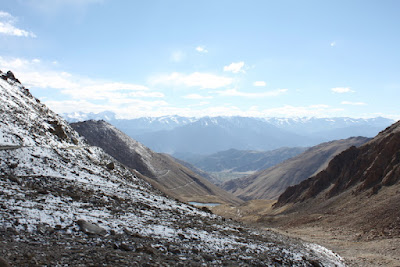
We hired a jeep and a driver, Dorje, (along with two Aussies we met on the flight up) to go see Pangong Tso - a lake on the border with Tibet which features on many of the postcards up here. We set out at six am and the drive would not be easy. It was five hours each way on bumpy roads along steep mountain trails and over the third highest motorable pass in the world - Chang La (5289m / 17352 ft).
Along the way, thoughtful signs from the Border Roads Organization kept us entertained as did the views of the valley and some monasteries along the route.
We stopped at the top of the pass for some photos and a quick cup of chai to warm us up. The top was pretty chilly and the air so thin that you start to get a headache after about five minutes and the cars don't run so well after about ten, so we quickly got back in the jeep and headed on towards the lake.
Pangong Tso is about 140 km long but only 40% is actually in India. The rest lies across the border in Tibet. If you're lucky enough to catch the weather on a good day, the blue color is surreal set against a backdrop of the swirling mineral colors of the mountains surrounding it. As you can see from our photos, we saw it on a good day :)
After a quick lunch in a Bedouin tent and a walk around the lake side we set off back the way we came for the long drive home.


No comments:
Post a Comment